Thorpe Oaks
&
Beaconfield
The History of the Use of the land
1664 to 2010
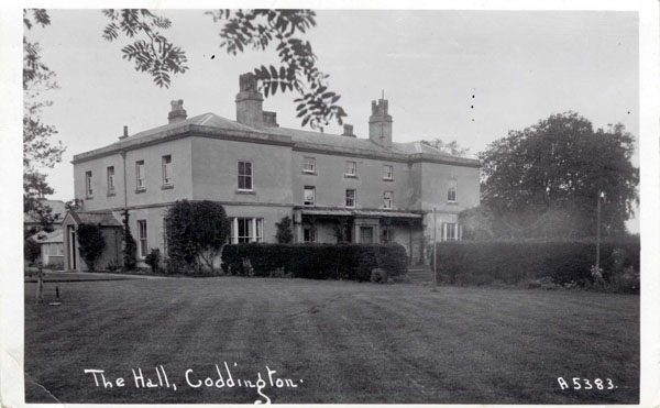
Thorpe Oaks Estate
59 acres formerly known as ‘Oaklands’
Before the Enclosure Act there was no estate as such. The estate was built up over a period of years and by a variety of owners.
Beaconfield Farm formed a major part of the estate prior to the Enclosure Act.
This was owned by the following families up to 1841:
1664 William Bell paid ‘Chimney Tax’ on a dwelling with 2 chimneys.
1674 William Bell paid ‘Chimney Tax’ on a dwelling which had 4 chimneys.
1679 Conveyance of lease and re-lease from William Bell to Edward Ward of South Scarle. Messuage and croft in occupation of William Bell, plus 4 cotts and 3 tofts adjoining 13 oxgangs.
1693 William Bell and Stephen Ashwell testify surrender of 1.5 bovates and messuage to use of William Fisher and his wife Elizabeth.
1712 William Fisher surrendered 1.5 bovates in Coddington to the use of himself and his wife, Elizabeth, for life and then to heirs John and Elizabeth Oliver and then on to the heirs of Elizabeth Oliver.
1720 John Oliver surrenders house and 1.5 bovates in Coddington to his will.
1723 John Oliver to Steven Oliver all houses and land in Coddington at the death of his mother.
1738 Elizabeth Oliver estate and house and 1.5 bovates to son Stephen and his heirs.
1740 – 1760 Information not yet available.
1762 Land held by Thomas and Elizabeth Heron in the Enclosure Act.
1762 Earliest record was 51 acres in the Enclosure Act awarded to Thomas Heron [freehold] shown on the Enclosure Map.
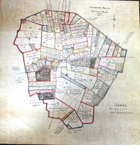
1780 The House is owned by Charles Colclough and this family owned the property until the turn of the century.
1782 John Coe now living on Colclough’s land. Land tax at £1:3:5p
1789 Sampson Colclough now living on the land and paying land tax at £1:12:5p
1795 Sampson Colclough paying land tax £1:12:5p
1813 The land is now owned by Thomas & Elizabeth Fisher
1826 John Wilson, tenant farmer on Fishers land.
1829 John Wilson’s will and sale of goods.
1830 Thomas Fisher pays land tax at £2:13:9p
Thomas Godfrey now resident in Beacon Field Hall.
1831 The Fisher land is now occupied by John Seagrave
1835 Beacon Field Hall now called Coddington Hall
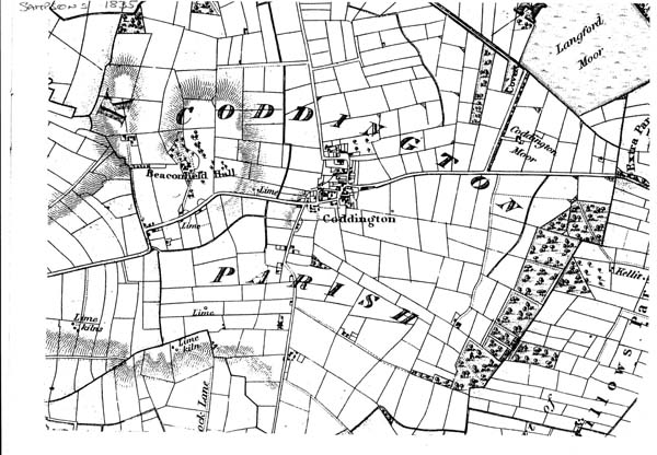
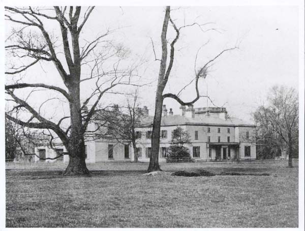

1841 Bought by James Thorpe, Maltster, Miller, Coal merchant, Corn Dealer etc. of Mill Gate Newark. paid Thomas Fisher £26,000 for the house and lands.
1861 William Proctor, farm manager for James Thorpe
1863 Thorpe added land purchased from Edward Chivers
1871 Joseph Smith, farm manager for James Thorpe
1876 Grounds used by Coddington Horticultural Society. Music by the band of Sherwood Rangers
1879 The house renamed Coddington Hall [fig2 photo]
1881 Rueben Lee, farm manager for James Thorpe
1886 Estate now 95 acres assessed at £126-17-6
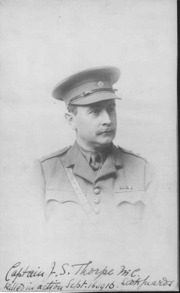
1903 Major John Somerled Thorpe, Sherwood Rangers Yeomanry. Second in command of B[Mansfield] Squadron. At the outbreak of WW1, he rejoined his original regiment, ‘The Scots Guards’.
1914 – 18 The grounds were used by the military as a training camp for soldiers to learn trench warfare before being sent to the front. The trenches that were dug were on the site of the A1 & fields between Coddington & Balderton.
The tents were on what is called Thorpe Oaks playing field and inspections were carried out.
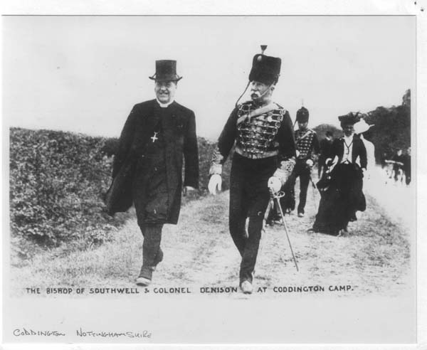
Picture shows the Bishop of Southwell & Colonel W E Denison.
1916 Captain John Somerled Thorpe killed in action as was W E Denison. Both were J P’s, Mr Denison being involved with the ‘Newark Advertiser’.
1918 Estate sold by auction. The house was kept back and sold separately.
1919 Land now referred to as Thorpe Oaks estate bought from the Thorpes byArthur Black of Kelham.
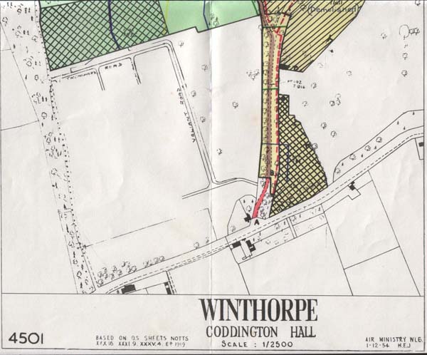
1930 The [white] houses along Newark Rd. towards Newark were built and sold by Arthur Black during this period.
1930 George H Judson moves into farm.
1937 Farm sold after Mr Judson’s death
1938 Farm owned by Frederick Clark
1939 Lands were leased to the War Department and later commandeered.
1945 The domestic site and administration for RAF Winthorpe which was built as a satellite to RAF Swinderby.
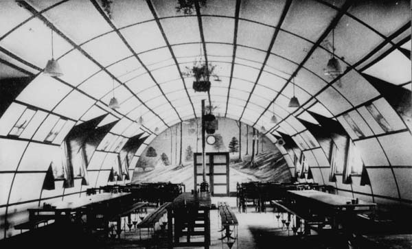
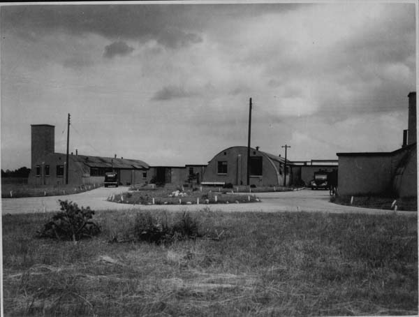
Examples of the type of hut built on the site
[courtesy of Newark Air Museum]
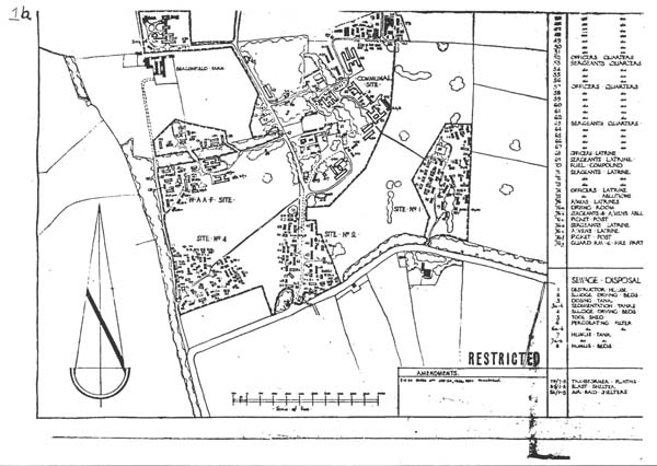
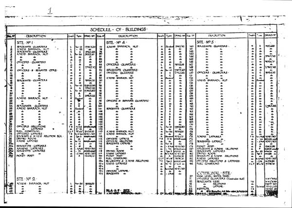
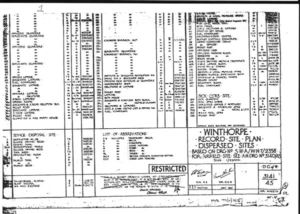
The RAF became involved during the 1930’s and they erected ‘nissan’ huts for the officers and men.
The site was divided into the usual areas which consisted of:
Officer’s quarters [now Parklands Close],
HQ and Admin. [Beaconsfield Drive estate],
Men’s area [now Bristol Close],
WAAF’s area [now Bryan Close, Claricoates Drive, Thompson Close & Youngs Close.
Sick Quarters was situated at and around Beaconfield Farm.
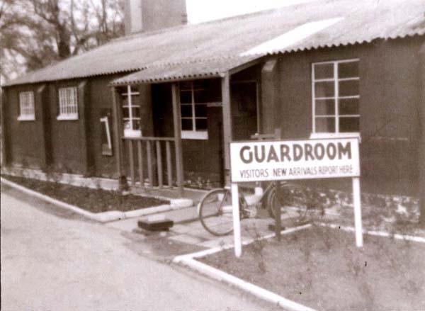
Guardroom and Security ran along the new Beaconsfield Drive that leads to the Beaconsfield estate.
Coal stocks for the entire site was in a compound alongside the guardroom area.
[please note: an ‘s’ has appeared in Beaconsfield.
This is due to a misprint during the planning permission stage for that estate and was not spotted until too late to change. The Claricoates name can be spelt with 2 ‘r’ s]
During WW2 the layout remained unchanged and served the airfield activities. Due to the fact that Marles [RHP] the bearings factory was in direct line with the runway. Loaded bombers were considered a major hazard to the war effort should they crash on take off and go into the factory. This would have interrupted the supply of bearing to Rolls Royce and others who were producing a variety of engines.
The airfield was then used as a maintenance base for fitting out aircraft and concerned with converting pilots to multi-engined aircraft and formation of crews i.e. pilots, navigators, gunners, bomb aimers & wireless operators before being dispatched to their various squadrons all along the East coast of the UK.
Some of the aircraft types that flew from RAF Winthorpe were:
Short Stirling
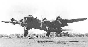
Avro Lancaster
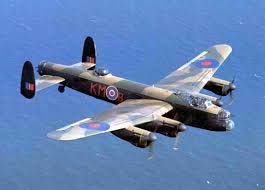
Handley Page Hampden
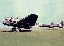
Handley Page Halifax
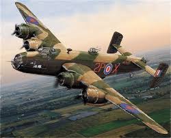
The end of the war saw a role change to airborne supply using Halifax bombers practicing parachute drops of equipment.
1955 Another role change and the building of proper housing for both officers & men which, of course saw the introduction of families accompanying their husbands.

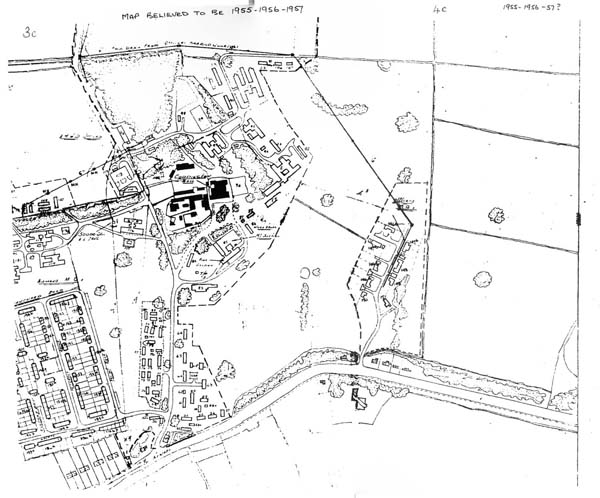
The streets on the NCO’s estate, [later known locally as Coddington camp], were named after prominent RAF senior ranks and aircraft in service at that time. Trenchard, Harvey, Valliant, Mitchell, Canberra, Sycamore & Beverley. The Officer’s quarters were called Parkland’s because that area of the estate had been the park. Old Hall Gardens was named for the same reason.
The role now became the production of the manuals and instructions for the modifying and servicing of an enormous range of modern equipment including advanced electronics.
During this period, the local school had to increase its intake due to the Married Families in the married quarters. Unlike the army or navy, the RAF used local facilities and fluctuations in the numbers of children was, and probably still is, borne by the local community.
1958 The transfer of the role to RAF Swanton Morley saw the end of the use ofthe airfield by the RAF. The Quarters were then used as overflow for such airfields as Waddington, Cranwell, Digby & Conningsby. This continued up to 1975. The airfield was inactive other than as a gliding club.
All the houses were transferred from the MoD to the Newark & Sherwood District Council and the Officers quarters were sold off by auction. The Non-Commissioned Men’s houses were used as council houses until 1999.
The pictures show the Camp in 1966 Harvey Avenue and, although labelled Coddington Road this is believed that this road is now Beaconsfield Drive running past the playing field as of now but then was the Guard room and security area just inside the Main Gateswhich was off Newark Road.
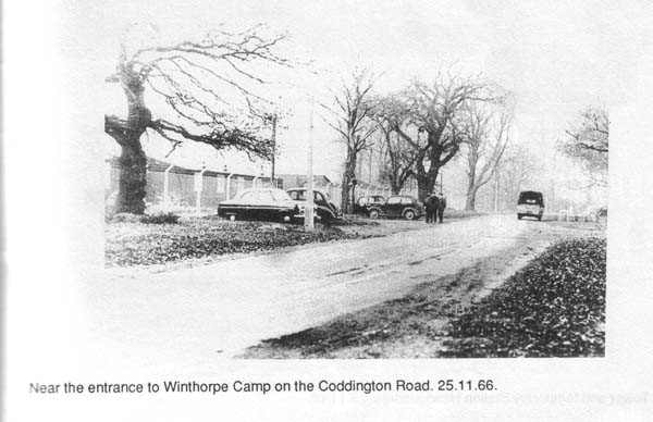
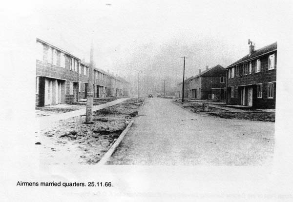
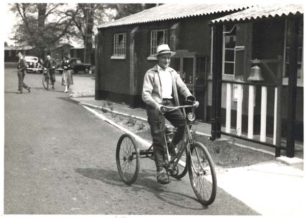
The ‘Coddington Comet’ 1956. 70yr old trike ridden by ‘Oscar’
The footprints of these buildings can still be seen during the summer when the conditions are right.
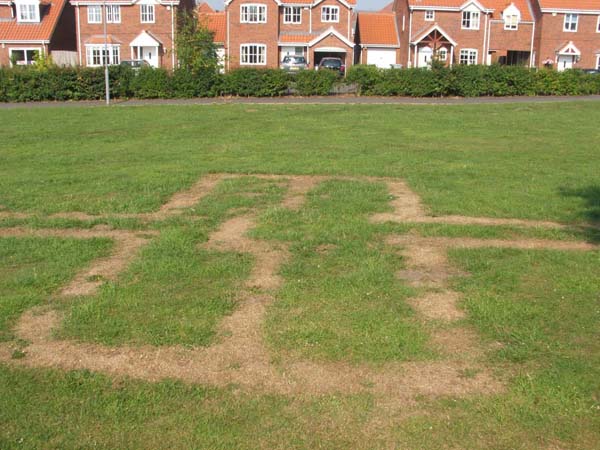
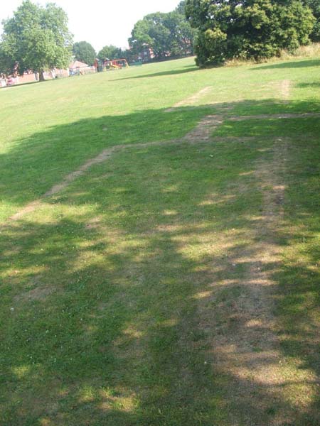
1960 The now derelict Hall was demolished
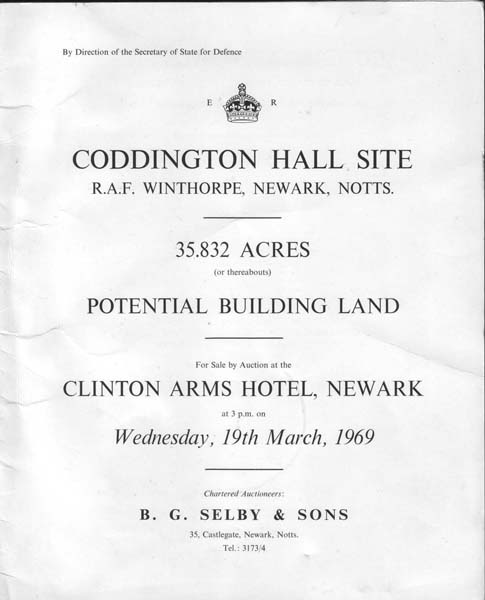
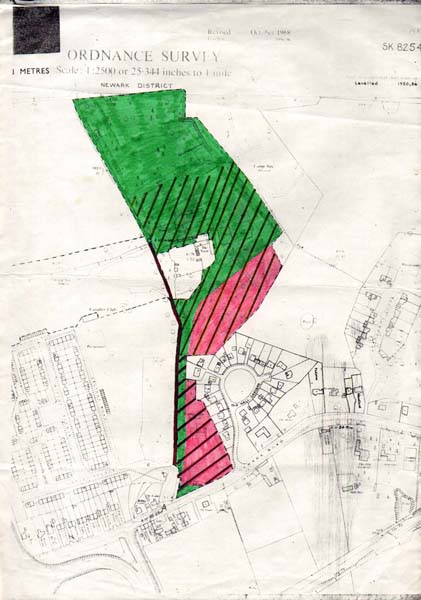
1969 Plots of land were auctioned off and ultimately became Penswick Drive, named in honour ofConstance Penswick Smith, the vicar’s daughter, who revived ‘Mothering Sunday’. Beaconsfield Drive estate was built on the site of the Hall which, during the 60’s, had fallen into decay and was demolished on the grounds of safety.
The streets were Beaconsfield Drive, Yew Tree Way, Ordoyno & Orchard Park. The latter being a separate development.
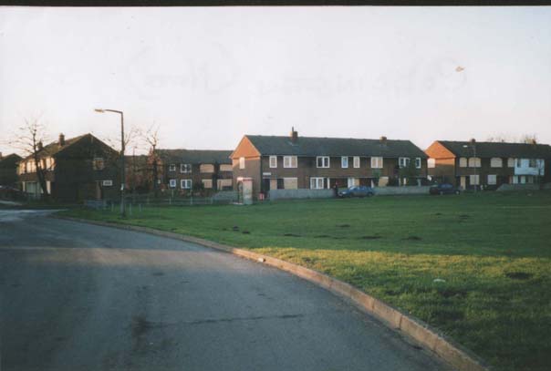
A view of the houses after being refurbished by the council and before demolition in 2000
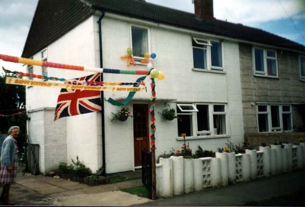
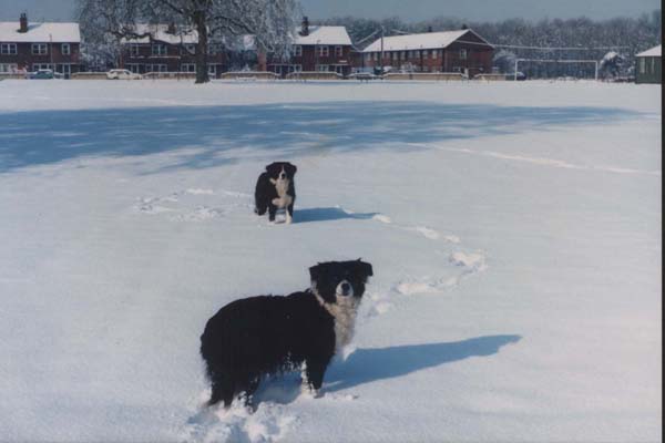
To the far right is the only picture of ‘Jubilee Club’. This was a wooden hut provided for the married families of the RAF personnel as an entertainment centre and was taken over by council tenants for the same purpose. It eventually became so dangerous and unstable that the Newark & Sherwood DC had it knocked down & and replaced by a brick built building.
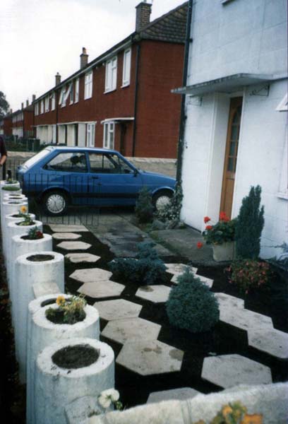
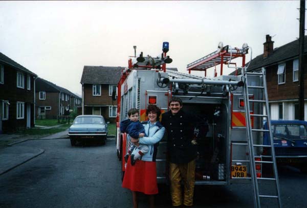
During Demolition
1999 The NSDC then sold the land to a developer and the present site was built for private properties with the retention of some social housing. The street names were chosen locally with the intention of retaining the historical contact with the RAF and including village men who gave their lives in both World Wars.
The houses started to be sold in 2002 and the whole estate was finished in 2006.
The streets are:
Lancaster Road, Thompson Close, Claricoate’s Drive, Young’s Close,Hampden Close, Henton Close, Bristol Close, Stirling Drive, Bryan’s Close.
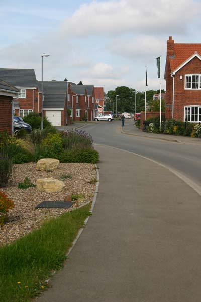
The single story building seen in the last photo replaced the old Jubilee Club
This was demolished and the 3 houses of Thompson Close were built along with a children’s play area. The picture shows the Opening Day.
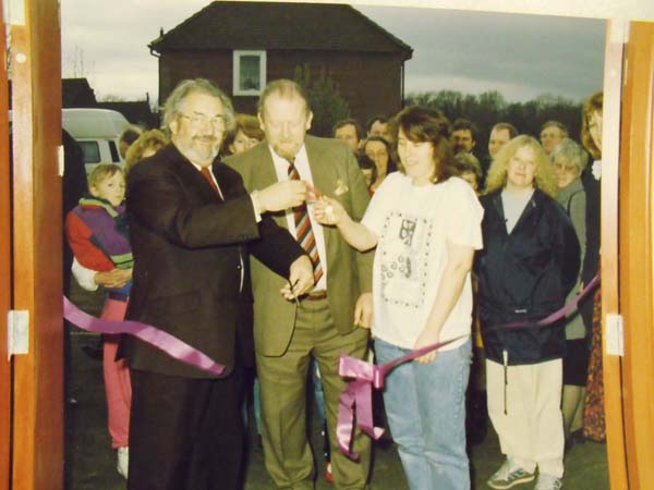
The new community centre was built next to the primary school in 2006.
The HQ & Administration area around the demolished house was bought and developed into Beaconsfield Drive estate incorporating Yew Tree Way, Orchard Park & Ordoyno Grove.
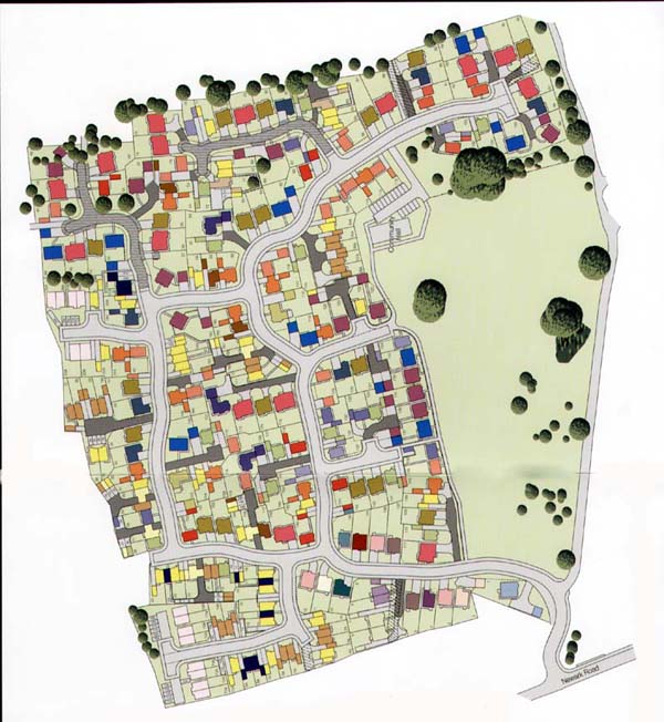
This is now the Thorpe Oaks estate with the Beaconsfield Drive estate off at the top right of the picture.
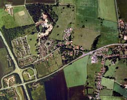
This shows that the Beaconsfield estate was built before the ‘Camp’ was demolished.
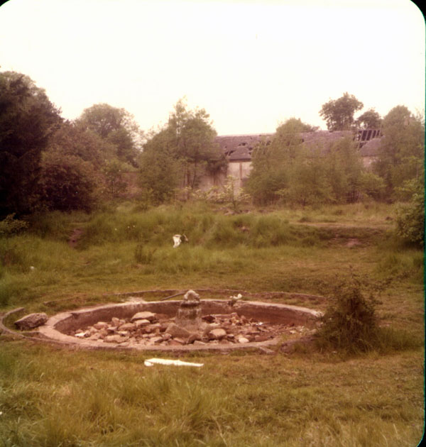
This is all that is left of beautiful well maintained gardens that were part of Coddington Hall. The buildings in the background are the only ones left standing and are privately owned and have been refurbished. They include the old kitchens and coach house of the Hall. This photo was around 1975 and the area stayed the same until the 90’s when building began. The pond was preserved and is still exists although it is now filled in.
research by Jane Hedge
compiled by Dave Hedge
